Every place on Earth has an address made of just two numbers. The Eiffel Tower is at about 48.858 degrees north, 2.294 degrees east. The Sydney Opera House is at about 33.857 degrees south, 151.215 degrees east. Those numbers are latitude and longitude, and once students understand them, they can find anything on any map or globe.
The invisible grid around the planet
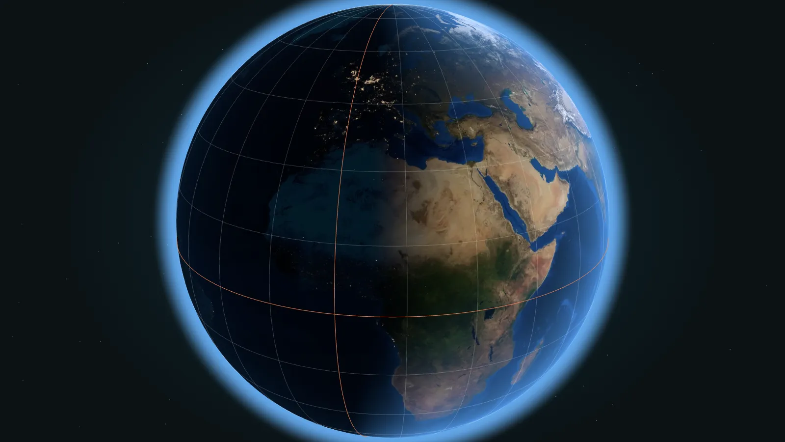
Mapmakers draw two sets of imaginary lines around Earth:
- Lines of latitude run east to west, like the rungs of a ladder. They measure how far north or south a place is.
- Lines of longitude run from the North Pole to the South Pole. They measure how far east or west a place is.
Where a line of latitude crosses a line of longitude, you get one exact point. That is a coordinate.
Latitude: north and south
Latitude starts at the equator, which is 0 degrees. It counts up to 90 degrees north at the North Pole and 90 degrees south at the South Pole. Lines of latitude are also called parallels, because they never meet.
One degree of latitude is always about 111 kilometers. So a city at 50 degrees north is roughly 5,500 km north of the equator.
Longitude: east and west
Longitude starts at the Prime Meridian, 0 degrees, which runs through Greenwich in London. It counts up to 180 degrees east and 180 degrees west, which meet on the opposite side of the world. Lines of longitude are called meridians, and they all meet at the poles.
Because meridians squeeze together toward the poles, a degree of longitude gets shorter as you move away from the equator. It is about 111 km at the equator, about 79 km at 45 degrees north or south, and zero at the poles.
How to read and write coordinates
You will see coordinates written in two main ways:
- Decimal degrees, used by phones and online maps:
40.689, -74.045. Negative latitude means south, and negative longitude means west. This one is the Statue of Liberty in New York. - Degrees, minutes and seconds, used on many printed maps: 40 degrees 41 minutes north, 74 degrees 2 minutes west. Each degree splits into 60 minutes, and each minute into 60 seconds.
More decimal places mean more precision. Two decimal places pin a place down to about a kilometer. Four decimal places get you within about 11 meters, roughly the size of a classroom.
Famous lines on the grid
Equator, 0 degreesSplits Earth into the Northern and Southern Hemispheres
Tropics, about 23.4 degreesCancer in the north, Capricorn in the south. The Sun can be directly overhead between them.
Polar circles, about 66.6 degreesArctic and Antarctic Circles, where the midnight sun begins
Prime Meridian, 0 degreesThrough Greenwich, agreed at an international conference in 1884
Around 180 degreesThe International Date Line zigzags here, where the calendar day changes
The Tropics and polar circles are not random: they come from the 23.4-degree tilt of Earth's axis. Our guide to day, night and the terminator explains why.
Live practice: where is the space station right now?
The International Space Station moves about 7.7 kilometers every second, so its coordinates change constantly. That makes it perfect for practice: the answer is different every time you look.
Ask students: Is the station in the Northern or Southern Hemisphere? Is it east or west of the Prime Meridian? Which continent or ocean is it over? Refresh after five minutes and see how far it has traveled. Learn more in how fast the ISS travels.
10-minute activity: coordinate treasure hunt
Give pairs of students these five coordinates and a world map or globe. The first pair to name all five landmarks wins.
27.988 N, 86.925 EMount Everest, Nepal and China29.979 N, 31.134 EThe Great Pyramid of Giza, Egypt22.951 S, 43.211 WChrist the Redeemer, Rio de Janeiro, Brazil43.723 N, 10.397 EThe Leaning Tower of Pisa, Italy40.432 N, 116.570 EThe Great Wall at Mutianyu, near Beijing, China
Cover the answers before you print. To stretch older students, ask them to write the coordinates of their own school, then swap with another pair and find each other's.
Questions students ask
Why does the Prime Meridian go through Greenwich?
In 1884, delegates from 25 countries met in Washington, DC and chose the meridian through the Royal Observatory in Greenwich as 0 degrees. Many sea charts already used it, which made it a practical choice.
Which is more important, latitude or longitude?
You need both. Latitude alone gives you a whole ring around the planet, and longitude alone gives you a line from pole to pole. Together they meet at a single point.
How does GPS know my coordinates?
Your phone listens to signals from several navigation satellites. By measuring how long each signal took to arrive, it calculates its distance from each satellite and works out its latitude and longitude.